To Identify visible features on the map:
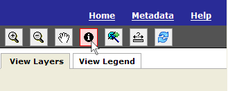
1) Select the Identify tool from the map tools toolbar in the upper right-hand corner of the application.
2) With your mouse pointer click on the map.
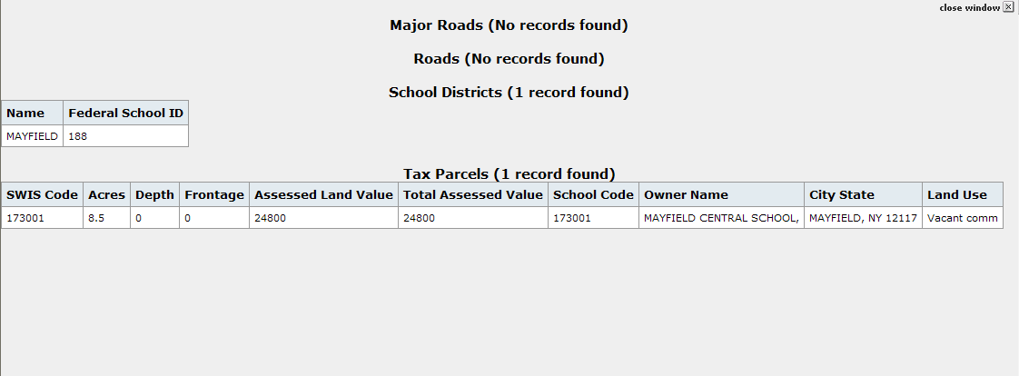
3) A new window of Identify Results will appear with the information on all the visible data layers at the geographic area that you clicked. For each data layer that is turned 'on' and visible in the map window, the attribute records for the features "identified" will be displayed.
The image below illustrates an example of the contents of the Identify Results Window when the Major Roads, Roads, School Districts, and tax parcels layers are turned 'on' and visible.