To measure the distance between features displayed in the map window:
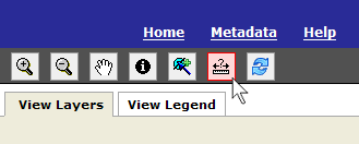
1) Select the Measure tool from the map tools toolbar in the upper right-hand corner of the application.
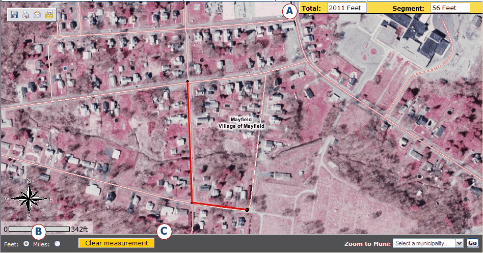
2) When the Measure tool is selected, the measure information box will appear in the upper right corner of the map window. See (A) in the image below. The measure information box will display the length of a segment and the total length of all segments drawn.
3) Click on the map where you want to start measuring. Move the mouse across the map to the location to stop measuring and click again. The points where you clicked will appear as black circles with a red line connecting them. The information box will calculate the segment distance between the two points.
Continue to click on the map and additional lines of measurement will be drawn. The information box will display the distance of the last segment in the Segment: box and the accumulative distance of all the segments in the Total: box
4) You may measure distance units in FEET or MILES. To select distance units, click the desired radio button that appears in the lower left corner of the map window, when the Measure tool is active. See (B) in the image below.
5) Click on the Clear Measurement button to erase the segments and set the 'segment' and 'total' values to zero. See (C) in the image below.